CPF Properties
Google Earth link click HERE
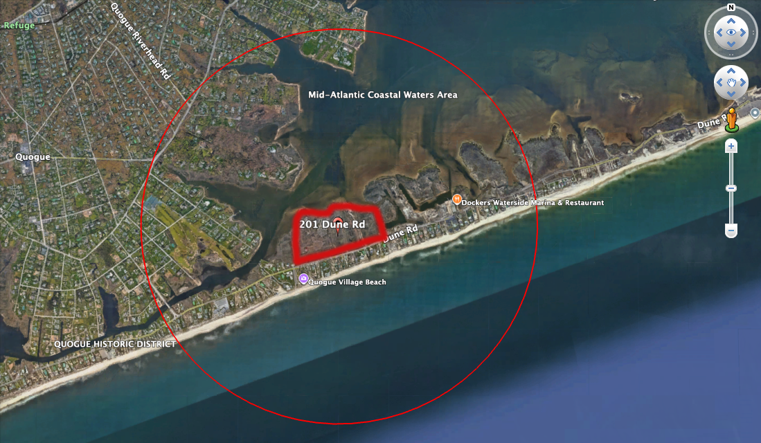
24-CPF - APPROVED WAIVER TO FLY ON SEPTEMBER 19, 2025, Friday, 390ft AGL, 1NM radius (shown on map in red line)
201 Dune Road, Quogue, New York 11959 - project center point
24-CPF 177, 178, 191, 201, 11, 215, 231 Dune Road
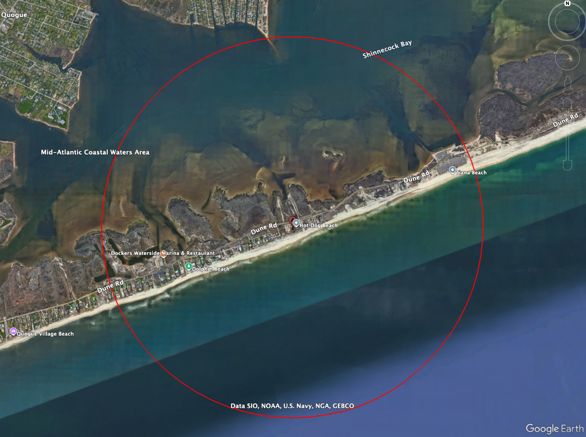
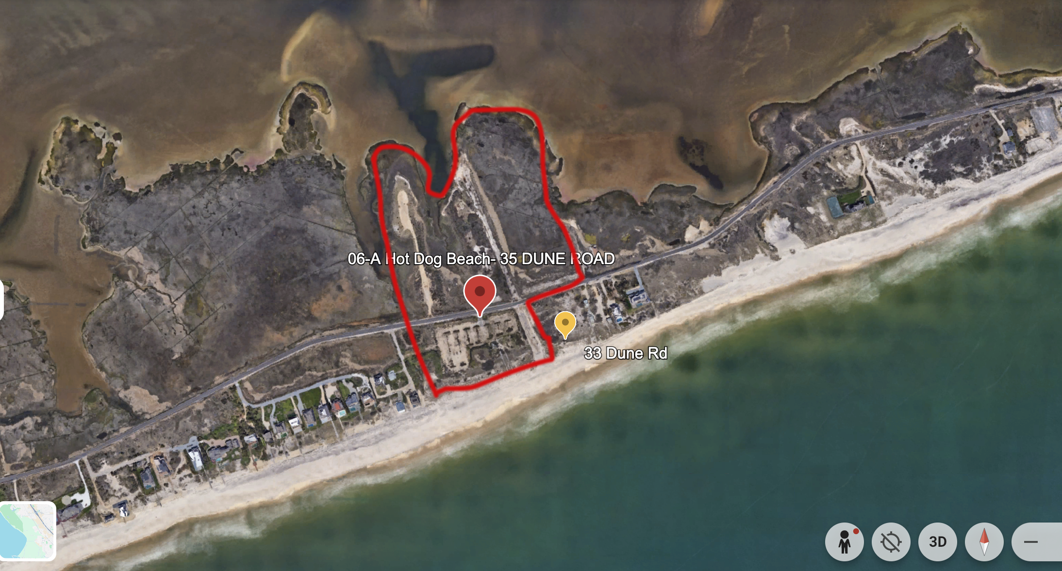
26-CPF - APPROVED WAIVER TO FLY ON SEPTEMBER 20, 2025, Saturday, 200ft AGL, 1NM radius (shown on map in red line)
35 Dune Road, East Quogue, New York 11959 - project center point
26-CPF 35 Dune Road - Hot Dog Beach
CPF PROPERTIES BELOW ARE UNRESTRICTED, HAVE LAANC AUTO-APPROVAL, OR EAST HAMPTON AIRPORT AIRSPACE
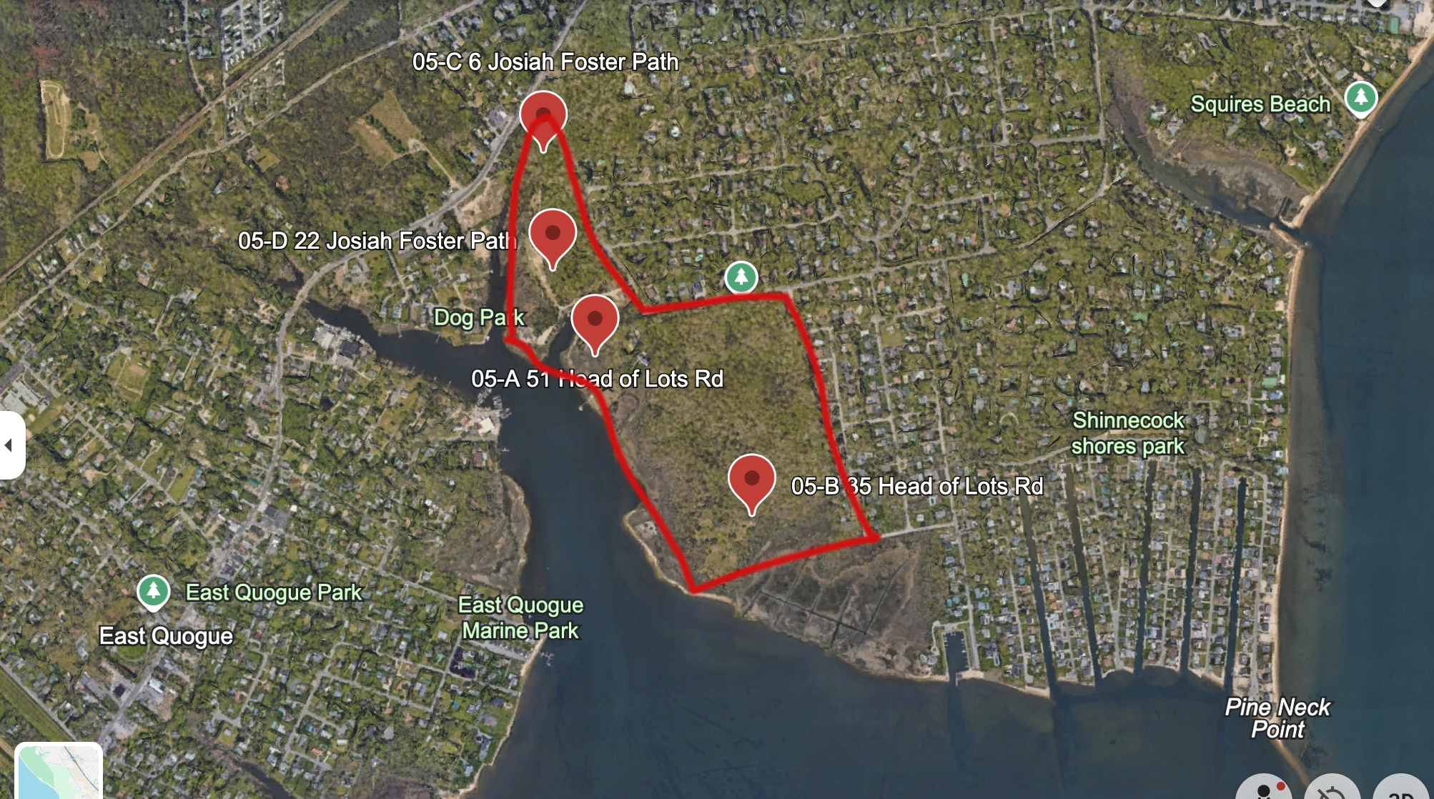
25-CPF - LAANC Auto-Approval available for 1 day for up to 12 hours per approval at an altitude of 400ft with a radius of 3,720ft (shown on map below)
35 Head of Lots Road, East Quogue, New York 11942 - project center point
25-CPF 35, 51 Head of Lots Road & 6, 22 Josiah Fosters Path
27-CPF - Unrestricted Airspace
9a Squiretown Road, Hampton Bays, New York 11946 - project center point
27-CPF 9A Squiretown Road - Good Ground Park

28-CPF - Unrestricted Airspace
116 West Montauk Highway, Hampton Bays, New York 11946 - project center point
28-CPF 116 West Montauk Highway - Lyson Hat Shop
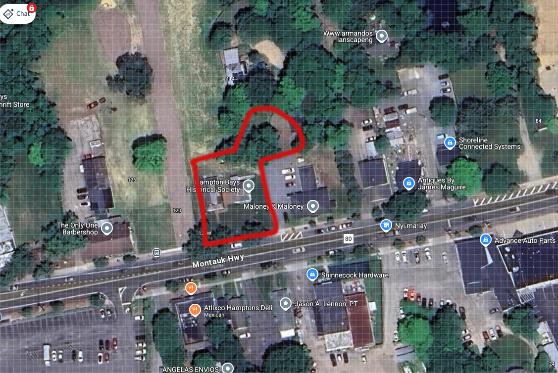
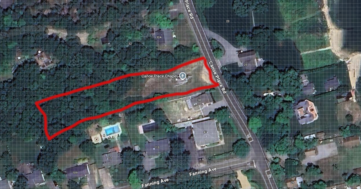
29-CPF - Unrestricted Airspace
36 Canoe Place Road, Hampton Bays, New York 11946 - project center point
29-CPF 36 Canoe Place Road - Canoe Place Chapel
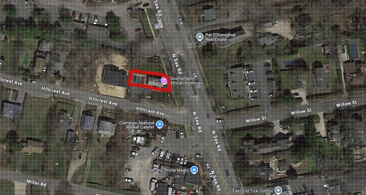
30-CPF - Unrestricted Airspace
245 North Sea Road, Southampton, New York 11968 - project center point
30-CPF 245 North Sea Road - SAAM
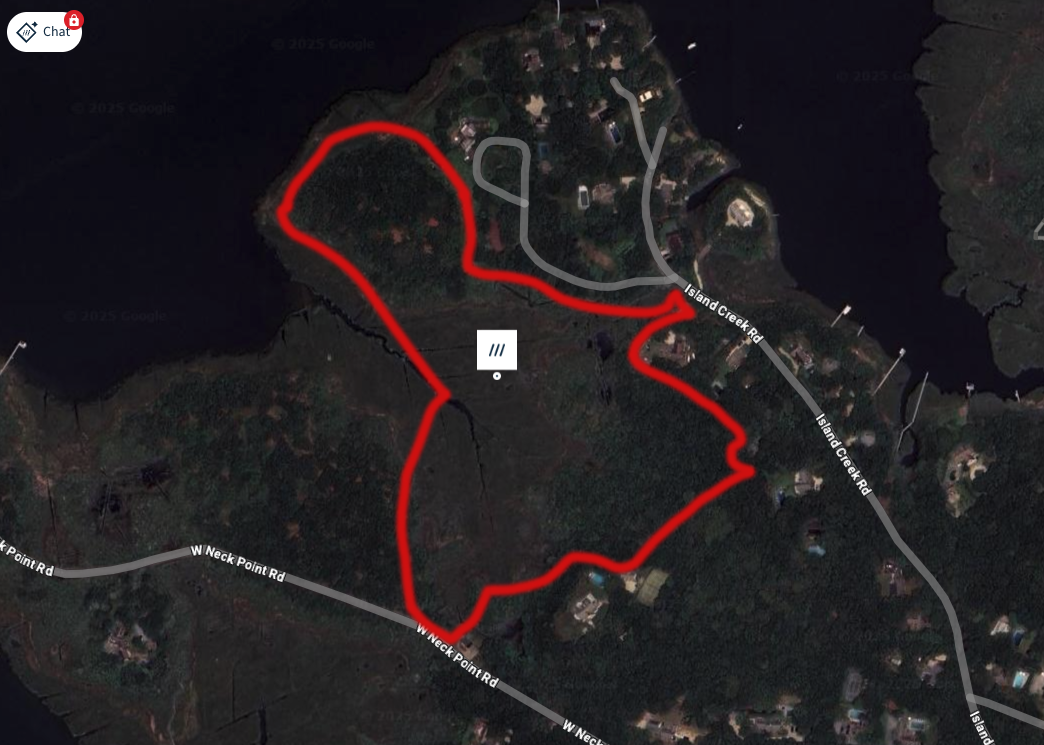
31-CPF - Unrestricted Airspace
77 Island Creek Road, Southampton, New York 11968 - project center point
31-CPF 77 Island Creek Road
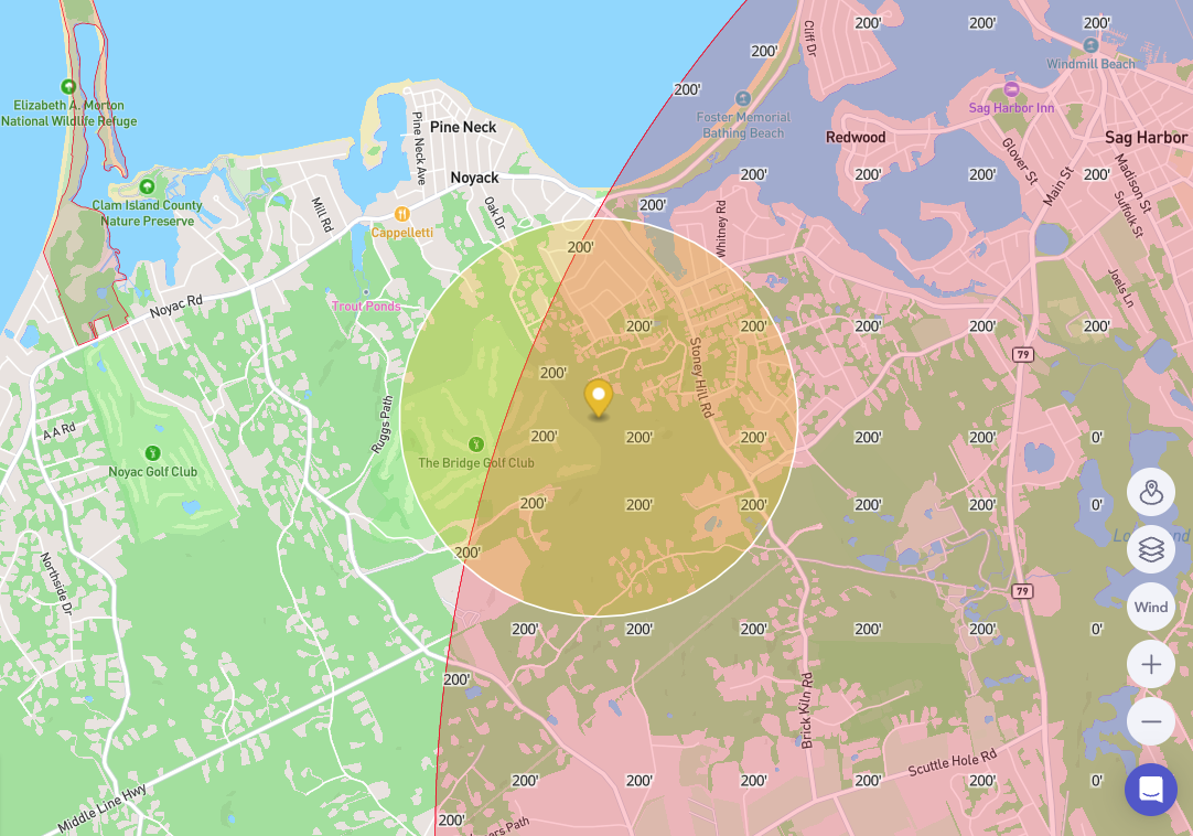
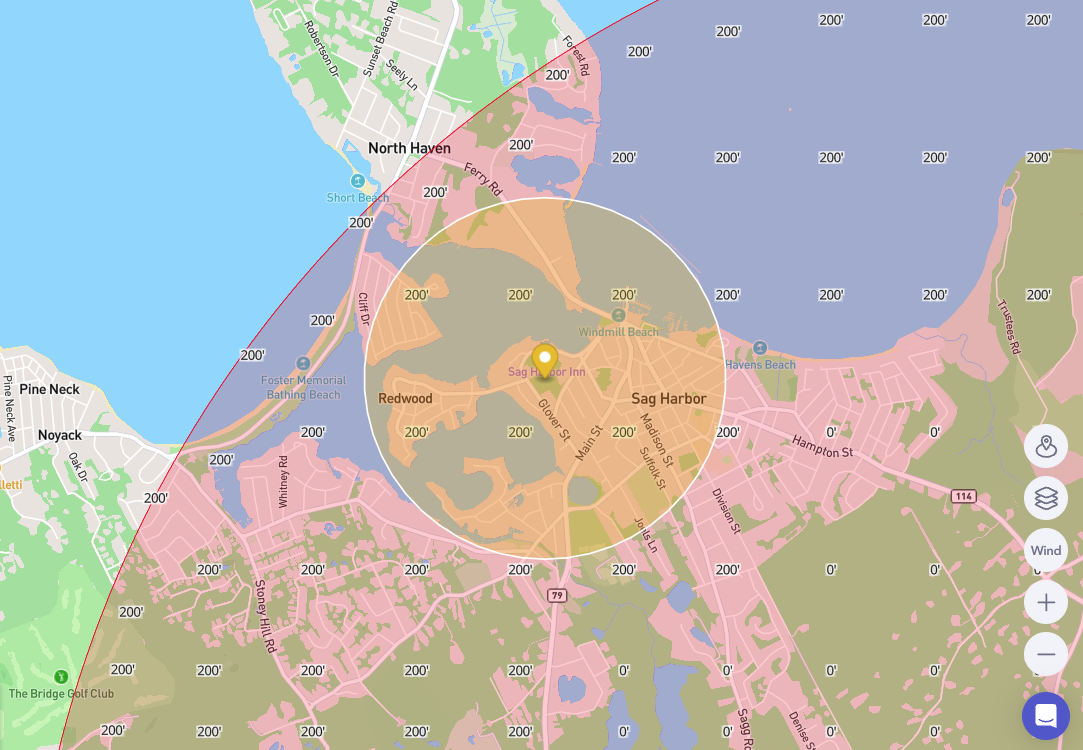
34-CPF - East Hampton Airport airspace, altitude map below (yellow circle showing 4,000ft radius). See map below for altitude restrictions in this area.
2 Bluff Point Lane, Sag Harbor, New York 11963- project center point
34-CPF 2 Bluff Point

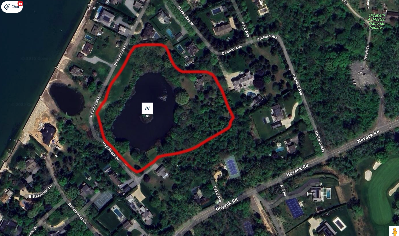
35-CPF - Unrestricted Airspace
12 Peconic Avenue, Sag Harbor, New York 11963 - project center point
35-CPF 12 Peconic Ave - Pond
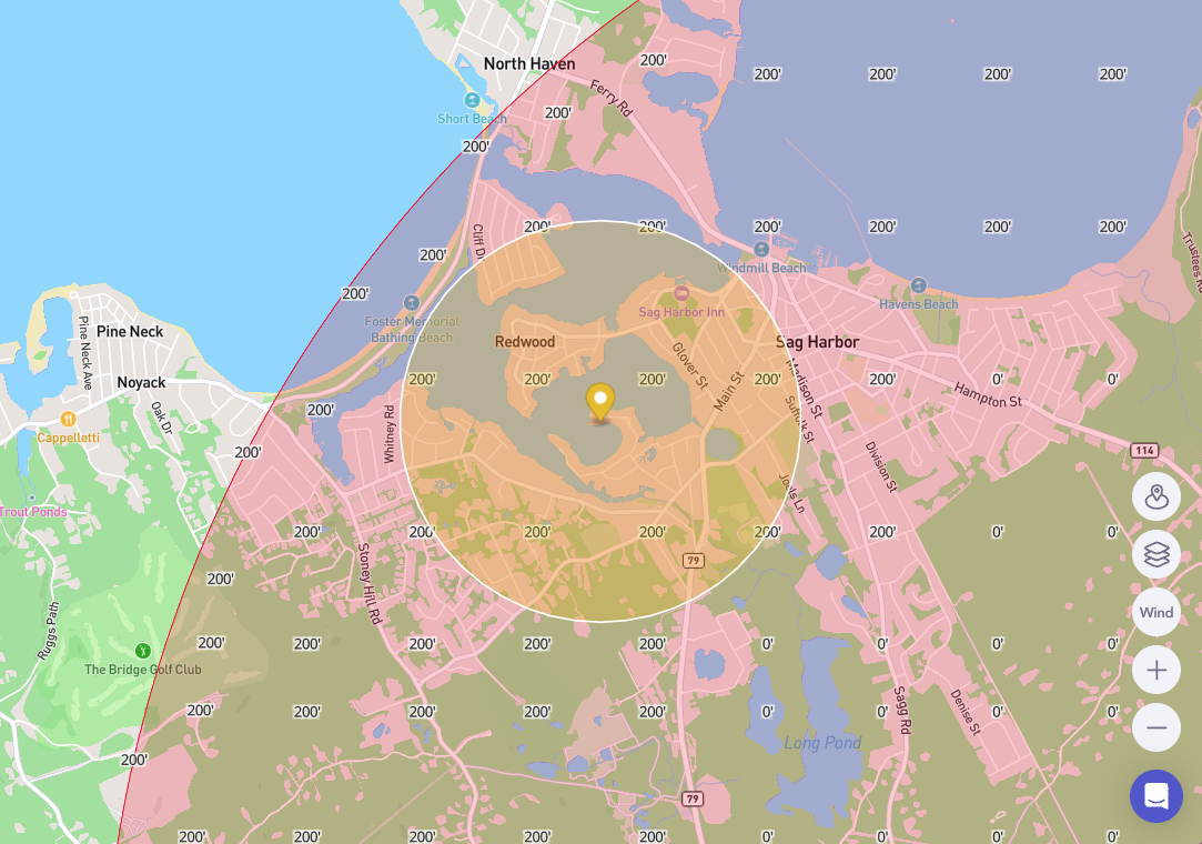
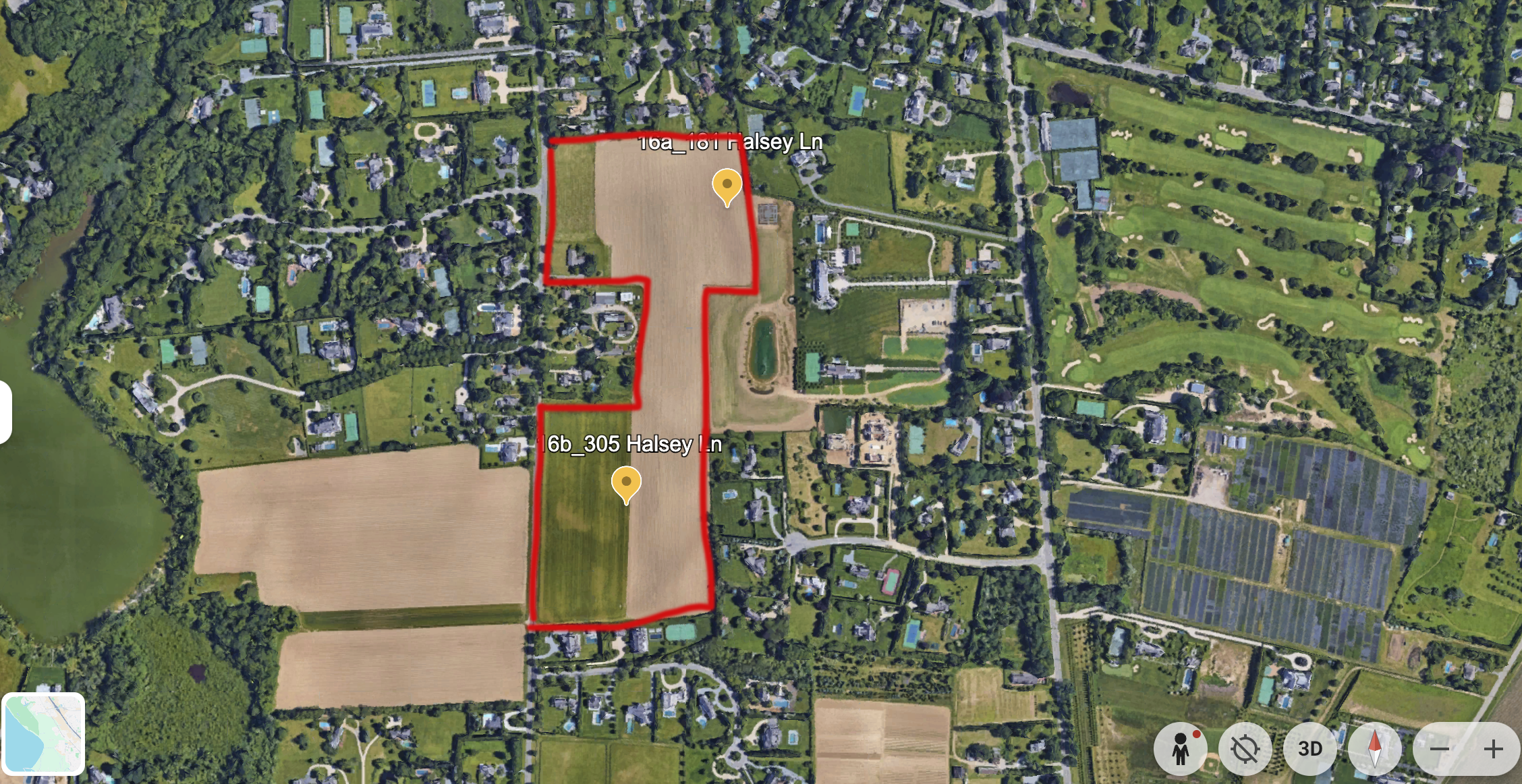
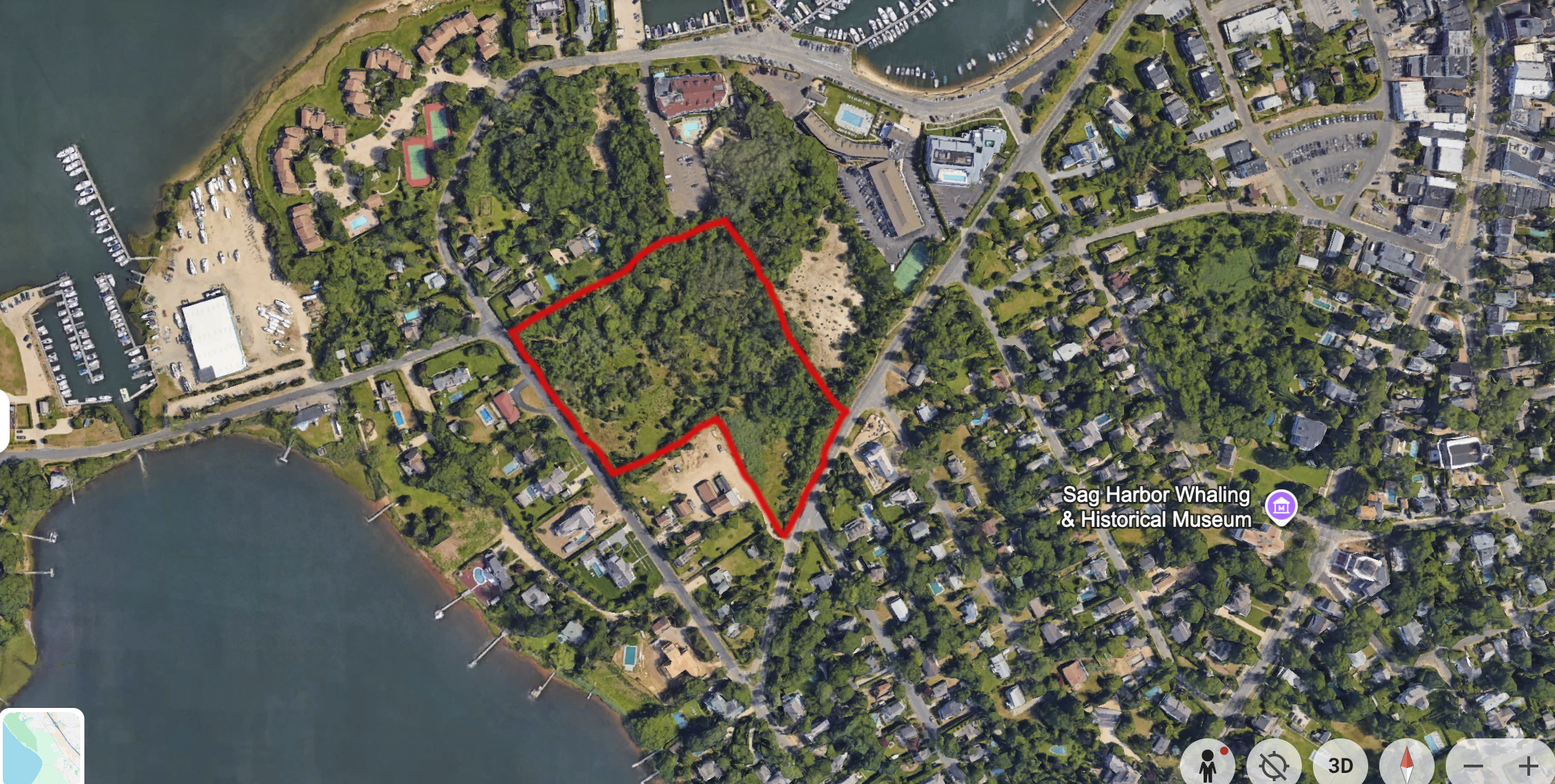
36-CPF - STILL UNDER FAA REVIEW, East Hampton Airport airspace, altitude map below (yellow circle showing 4,000ft radius)
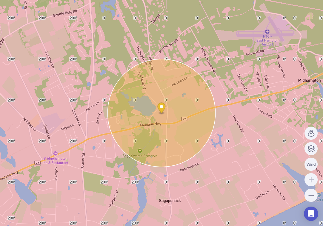
181 Halsey Lane, Bridgehampton, New York 11932 - project center point
36-CPF 181, 305 Halsey Lane - Farmland
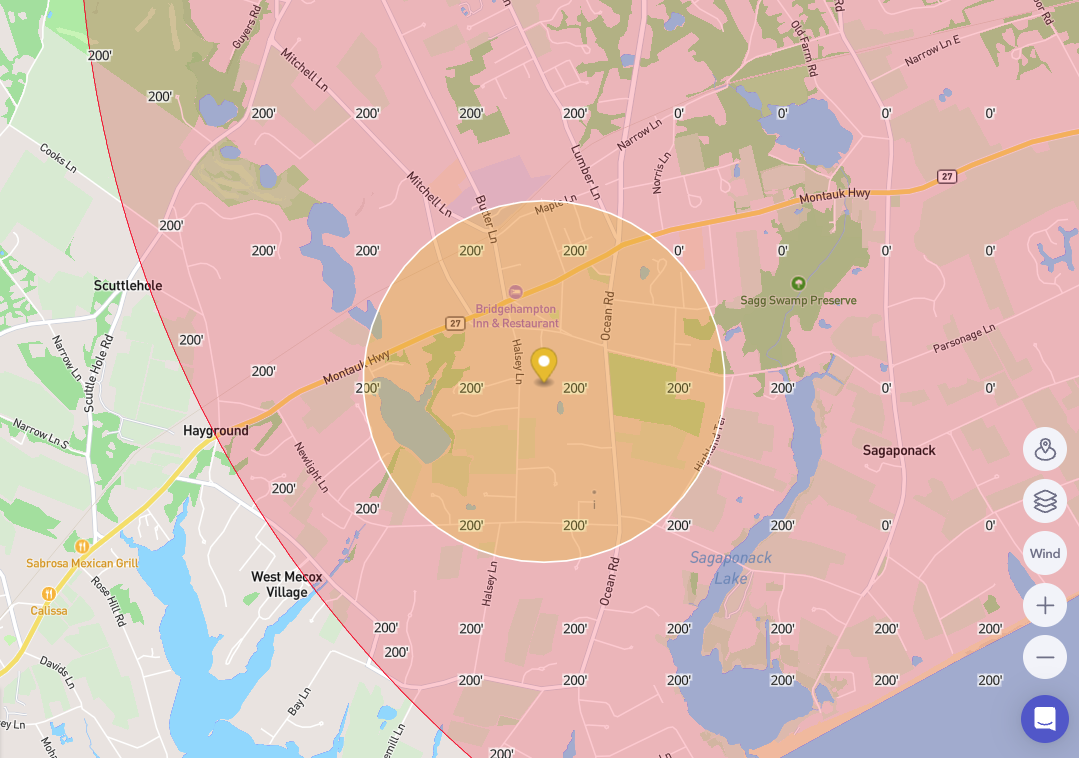
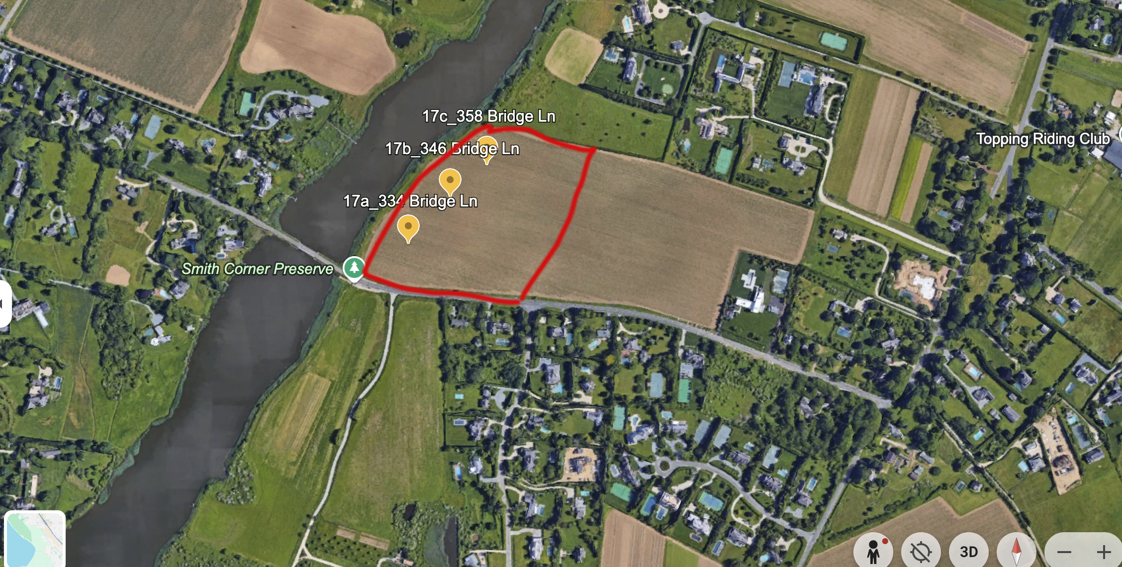
37-CPF - East Hampton Airport airspace, altitude map below (yellow circle showing 4,000ft radius). FAA Waiver approved for Class E airspace from Sept 17 - Sept 30 specifically at altitude limits on image below with a range of 1NM from center point.
334 Bridge Lane, Sagaponack, New York 11962 - project center point
37-CPF 334, 346, 358 Bridge Lane
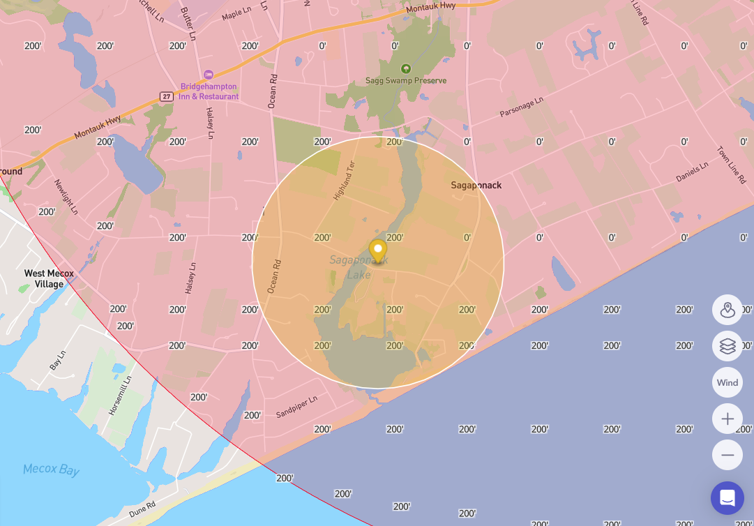
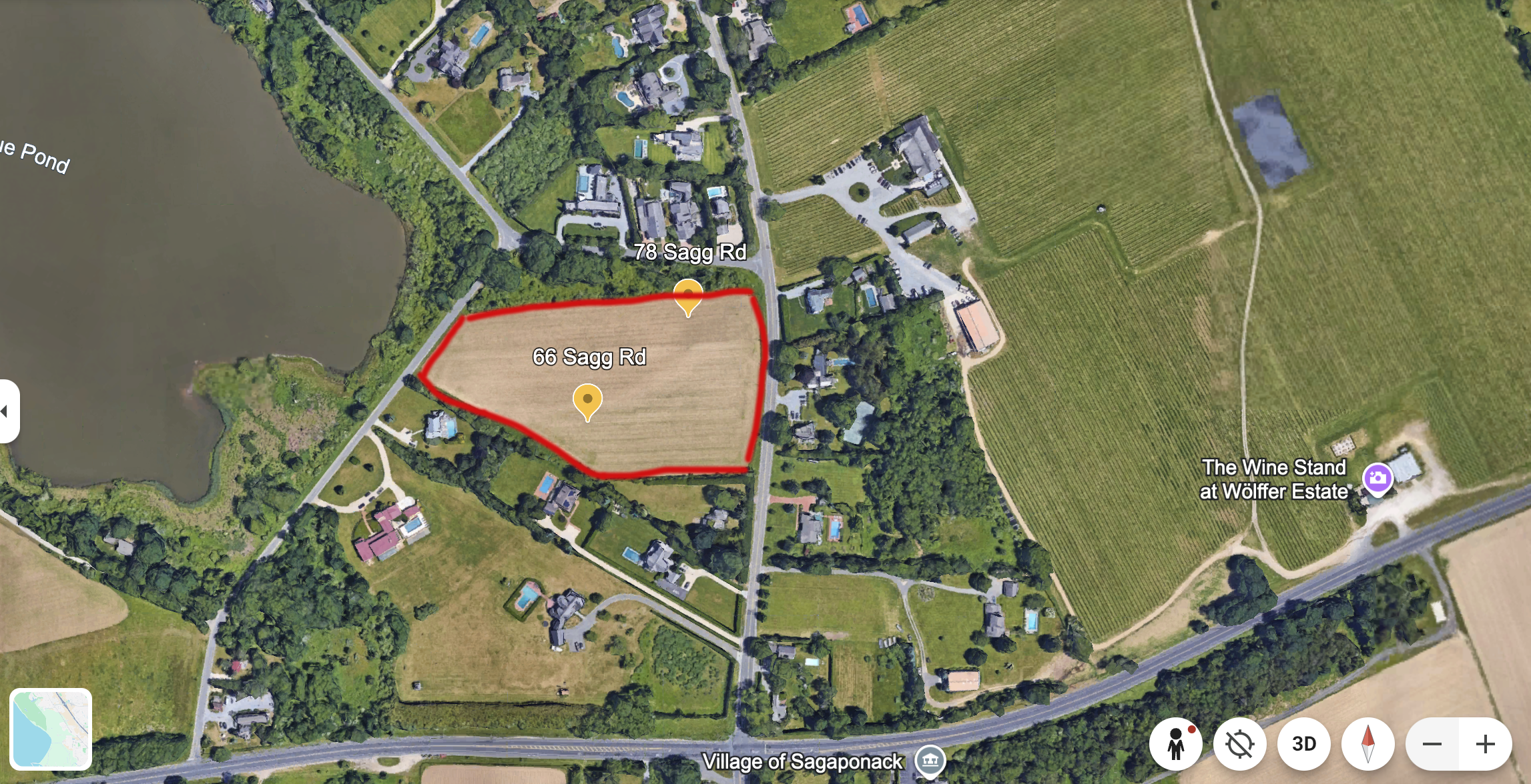
38-CPF - FAA DENIED WAIVER, CITING THAT THE CENTER POINT AND SURROUNDING RADIUS IS IN A 0FT ALTITUDE AREA (AS SEEN ON MAP BELOW)
East Hampton Airport airspace, altitude map below (yellow circle showing 4,000ft radius)
66 Sagg Road, Sagaponack, New York 11962- project center point
38-CPF 66, 68, 78 Sagg Road & 135 Poxabogue Lane
39-CPF - East Hampton Airport airspace, altitude map below (yellow circle showing 4,000ft radius). FAA Waiver approved for Class E airspace from Sept 17 - Sept 30 specifically at altitude limits on image below with a range of 1NM from center point.
55 West Water Street, Sag Harbor, New York 11963 - project center point
39-CPF 55 West Water Street - Cilli Farm Park
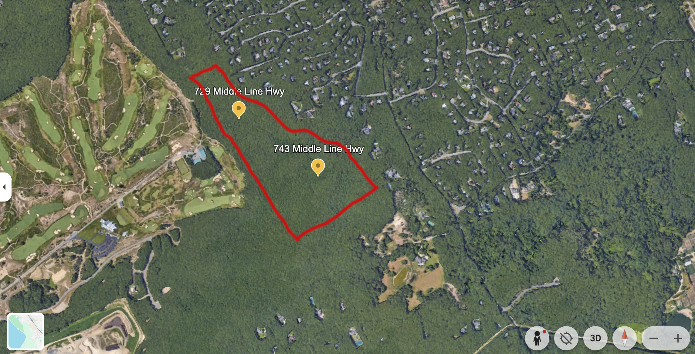
40-CPF - East Hampton Airport airspace, altitude map below (yellow circle showing 4,000ft radius), FAA Waiver approved for Class E airspace from Sept 17 - Oct 3 specifically at altitude limits on image below with a range of 1NM from center point.
729 Middle Line Hwy, Sag Harbor, New York 11963 - project center point
40-CPF 729, 743 Middle Line Highway